Science
ETH tests radar drone to predict Alpine landslides
ETH Zurich researchers are testing a radar-equipped drone that can detect tiny movements in glaciers and help forecast landslides and rockfalls. The project aims to improve monitoring as thawing permafrost increases natural-hazard risks in the Alps.
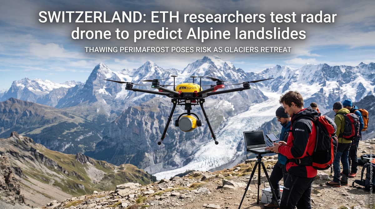
A radar-equipped drone is now scanning one of Valais’s moving glaciers for signs of change. In the Lötschental valley, an ETH Zurich research team has sent a large drone over the Oigschtchummun glacier above Blatten. A radar unit mounted beneath the aircraft sends electromagnetic waves towards the ice and surrounding terrain, then records the returning signals.
The test comes as thawing permafrost makes the surveillance of Alpine slopes more important. Frozen ground helps bind rock and soil together. As it warms, slopes can become more unstable, increasing the need for earlier and more precise warnings of landslides and rockfalls. The drone will not deliver a stand-alone forecast, but it could give authorities a faster view of movement in places that are difficult or dangerous to reach.
The first flights have been promising, according to Swiss Geolab managing director Felix Seidel. The researchers selected the glacier because it is already moving and is covered by established monitoring systems. That gives them a reference against which to check the drone’s readings.
A repeat scan after 20 minutes can already reveal a small shift in the glacier. Detecting such movement does not automatically predict a collapse, but it gives scientists a detailed time series that can help identify changes in behaviour.
Use Radar When Clouds Close In
Radar can keep working when cloud cover blocks the view from above. Conventional rock-monitoring systems often use lasers to detect changes in a slope or glacier surface. Laser measurements can be highly precise, but dense cloud, mist and other atmospheric conditions can interrupt them.
The radar system being tested by ETH Zurich and Swiss Geolab uses electromagnetic waves. That allows researchers to collect data through clouds, according to Seidel. In the Alps, where weather can change quickly and steep terrain frequently disappears into fog, that added resilience could extend the periods in which scientists can monitor a site.
The Oigschtchummun glacier offers a practical testing ground. Its movement is already measured by conventional monitoring, allowing researchers to compare the drone’s results with regular observations. The comparison will help establish how accurately the airborne system can map small shifts and how reliably it performs in different conditions.
The aircraft also offers operational flexibility. Researchers can send it over a glacier, scree slope or rock face without placing people directly on unstable ground. In future deployments, the drone could carry sensors to selected points in the terrain, creating a denser network of measurements than a single flight can provide. The coming months will bring further tests on glaciers and scree slopes.
Link Satellites, Drones and Sensors
The drone is one layer in a wider Swiss hazard-monitoring system. Swiss Geolab also supports satellite-based surveillance, which can scan large parts of the Alpine region regularly and identify areas showing signs of movement. That broad coverage helps researchers decide where to concentrate more detailed investigations.
Satellites have limits. Seidel said they do not provide the detail needed to inspect steep slopes or look into difficult rock faces. A satellite image may flag a valley or mountainside for closer attention, while a drone can then be dispatched to examine the specific section in greater resolution.
This combination is particularly relevant in Valais, where villages, transport links and mountain infrastructure sit beneath steep terrain. The approach links three scales of observation: satellites for regional screening, drones for targeted inspection, and ground sensors for continuous local measurements.
The system is designed to reduce unnecessary exposure for field teams. A drone can reach terrain that is unsafe for people to approach, while sensors can remain in place after the aircraft leaves. Those tools still require expert interpretation. Movement may reflect seasonal ice dynamics or other natural processes, so measurements must be assessed alongside geology, weather and existing records before authorities act.
Turn Radar Data Into Decisions
The project’s value will depend on how quickly measurements become usable decisions. ETH Zurich and Swiss Geolab want to process the information with artificial intelligence so that authorities do not have to interpret every complex radar dataset from scratch. The stated aim is to place the right information in front of the right person, in the right format and at the right time.
That could support municipal emergency planners, cantonal authorities and specialists responsible for roads, railways and mountain settlements. A system that identifies a changing slope early could help direct a field inspection, adjust a monitoring schedule or inform decisions about access. The source material does not claim that the drone can predict every landslide, and the researchers still need to validate the technology across more sites and conditions.
The distinction matters. A detected movement is a warning signal, not a guaranteed failure. Authorities need reliable thresholds, clear responsibility and enough local knowledge to judge what the data means. Artificial intelligence can sort and highlight patterns, but decisions will remain tied to engineering assessments and emergency procedures.
The coming test flights will show whether the radar drone can move from a promising research instrument to a dependable part of Switzerland’s hazard-monitoring network.
Expand the Tests Across the Alps
Researchers plan to expand the flights across glaciers and scree slopes in the months ahead. The next phase will test whether the system works beyond the Oigschtchummun glacier and whether it can support the different monitoring needs of ice fields, unstable rock faces and loose mountain debris.
For Switzerland, the practical test is coverage. The Alps contain thousands of slopes and glaciers, while many areas are remote, steep or exposed to rapidly changing weather. Satellites can survey the wider region, but drones may supply the close-up information needed to assess a specific hazard. Ground sensors could then track that location over a longer period.
The research also reflects a shift in how Alpine risks are managed. Monitoring increasingly combines remote sensing, repeated measurements and automated analysis. That does not remove uncertainty from natural hazards, but it can improve the evidence available before a decision about a road, trail, settlement or construction site.
The Valais flights are an early demonstration rather than a finished warning service. Their success will be judged by accuracy, reliability and how easily cantonal and local authorities can use the results. If those tests continue to deliver precise readings, radar-equipped drones could become a practical tool for watching Switzerland’s most difficult slopes.