Switzerland
MétéoSwiss deploys AI to improve warnings for severe thunderstorms
MétéoSwiss has introduced an AI system that updates the probability of hail, lightning and heavy rain every five minutes. The article should explain how the model works, what its improved warning speed means for public safety and why meteorologists remain essential to interpreting its forecasts.
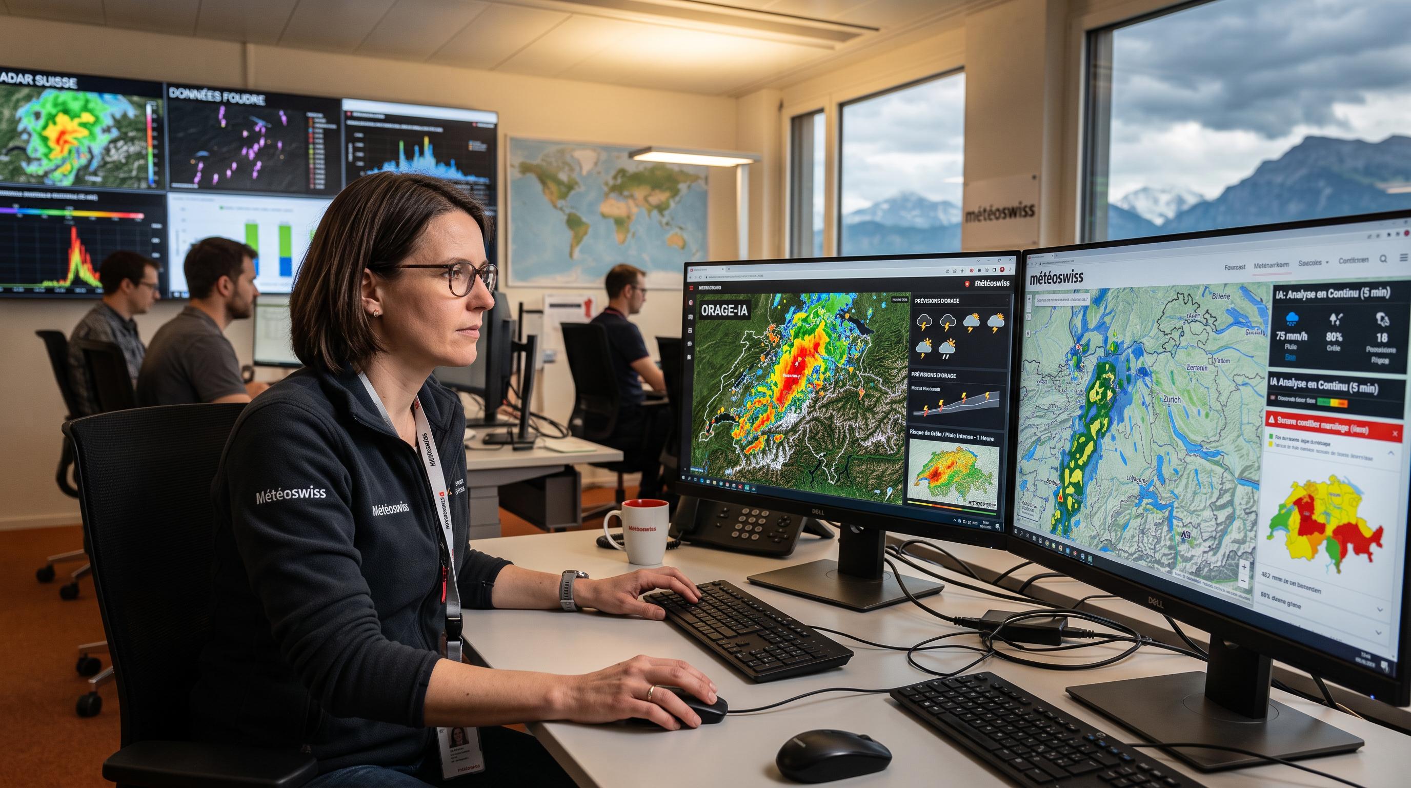
MétéoSwiss Puts Five-Minute Storm Warnings Into Service
Five-minute updates could give people across Switzerland more time to react when thunderstorms form. MétéoSwiss has placed a new artificial intelligence system into operation this summer, targeting three hazards that can change rapidly: hail, lightning and intense rainfall.
The system analyses radar and lightning data covering the entire country, then estimates the probability of each hazard during the coming hour. It sends that information to the MétéoSwiss app and website, where users can consult warnings for their location.
MétéoSwiss announced the deployment on August 27, 2026, after four years of development. The Swiss government says the system should help reduce false alarms while allowing warnings to reach the public more quickly. That matters in a country where weather conditions can shift sharply between the Alpine valleys, the Plateau and the Jura.
A warning that arrives sooner can influence practical decisions: whether to postpone a hike, move outdoor equipment, leave an exposed area or protect vehicles from hail. The tool does not predict every storm with certainty. It provides frequently refreshed probabilities that can support faster decisions as conditions evolve.
Radar, Lightning and Deep Learning Drive the Forecast
The model learns from how Swiss thunderstorms move and develop, rather than relying only on a single forecast snapshot. MétéoSwiss trained a deep learning algorithm on a vast dataset of radar and lightning observations collected across Switzerland.
The training process required substantial computing power and took place on supercomputers in Lugano. By processing past patterns, the system learned to connect observed storm signals with the later appearance of hail, lightning and heavy rain. It now repeats that analysis every five minutes, producing a rolling outlook for the next hour.
This approach suits thunderstorms because their location and intensity can change quickly. Radar shows precipitation structures, while lightning data provides information about electrical activity within storms. Together, those inputs give the algorithm a frequently updated picture of developing hazards.
The output is expressed as a probability, not a guarantee. That distinction is important for anyone reading an app alert. A high probability indicates increased risk in a particular area and period. It does not establish precisely where hail will fall, how much rain will accumulate or when the next lightning strike will occur.
Earlier Alerts Give Communities More Room to Act
Faster warnings have value only when people can understand and act on them. A five-minute refresh gives the public a more current view of storm risk than a forecast that remains unchanged while a cell moves across the country.
For residents, the practical benefit may be straightforward. A hiker can reconsider an exposed ridge. A sports organiser can pause an event. Farmers can move machinery or livestock when hail and heavy rain become more likely. Transport operators and local authorities can also use updated warnings when managing outdoor activity and vulnerable infrastructure.
The national coverage is especially relevant in Switzerland's varied terrain. Thunderstorms can develop near the Alps and affect valleys, passes or nearby communities at different times. An alert designed for one area does not automatically describe conditions elsewhere, which makes location-specific information important.
MétéoSwiss says the system is intended to reduce false alarms as well as accelerate warnings. Better targeting can help preserve public trust, since repeated alerts for storms that never arrive may cause users to ignore later notifications. The new tool therefore supports both speed and selectivity, while leaving people responsible for how they respond.
Human Expertise Still Interprets the Algorithm
Meteorologists remain the decision-makers who place an automated forecast in context. MétéoSwiss says specialists must continue to assess complex weather situations and apply scientific judgement when interpreting the algorithm's results.
That role matters because a probability does not explain every consequence. Meteorologists can compare the model's output with wider atmospheric conditions, examine how a storm is changing and identify situations in which local terrain or unusual development complicates the forecast. They also determine how information should be communicated to the public.
The system's deployment follows a wider debate about artificial intelligence and extreme weather prediction. A separate Swiss study, linked in the source report, examined limits in AI forecasting for extreme events. Those limits reinforce the need for human oversight, careful verification and clear communication about uncertainty.
For Switzerland, the immediate change is operational rather than a replacement of the forecasting service. AI processes radar and lightning information at regular intervals. Meteorologists evaluate what that information means. Users receive a faster warning channel, while professional expertise remains central to deciding how much confidence the forecast deserves.
Switzerland Begins Testing the Next Warning Layer
MétéoSwiss has made AI part of Switzerland's warning infrastructure, with performance now tested in real summer conditions. The system entered service after four years of development, but its public value will depend on how reliably it handles different storm structures, regions and levels of intensity.
The five-minute cycle creates a continual stream of updated information. That can improve situational awareness for the public and for organisations that manage outdoor activity, emergency planning or exposed infrastructure. It also creates a responsibility to explain what each warning means, how long it applies and why conditions may change.
MétéoSwiss's approach keeps the algorithm within a broader scientific workflow. Supercomputers in Lugano supplied the computing capacity needed for training. Radar and lightning observations provide the live inputs. Meteorologists review the evolving situation and interpret the results for users.
The result is a new layer in Switzerland's severe-weather system, not a standalone replacement for professional forecasting. As the service gathers operational experience, its most important test will be whether quicker, more precise warnings help people make better decisions before hail, lightning or heavy rain arrives.