AI
Written with AI assistance•February 24, 2026•
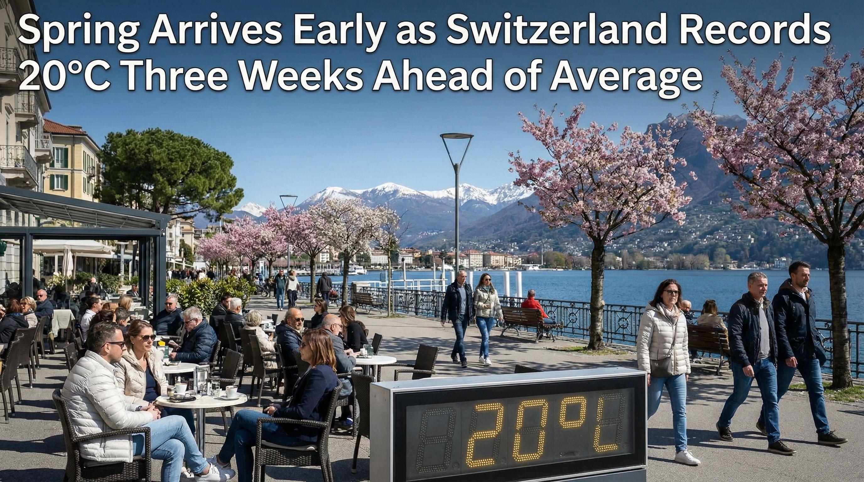
Unseasonably warm weather has arrived in Switzerland, with temperatures topping 20°C in Ticino. This significant meteorological event occurred approximately three weeks earlier than the long-term average for the region.
"This ridge of high pressure will bring very mild air from the southwest to our region."
"Temperatures will be very mild in the afternoon, often reaching or exceeding 15C, though highs approaching 20C are possible."
Winter has been abruptly shown the door in Southern Switzerland. In a striking meteorological development, the mercury in Cevio, Ticino, surged past the psychological 20°C barrier on Tuesday afternoon, signaling an aggressive and premature start to spring. This isn't just a mild afternoon; it is a statistical outlier that demands attention.
According to definitive measurements from MeteoSwiss, this breach of the 20°C mark has arrived a staggering three weeks ahead of schedule. Historically, the southern side of the Alps waits until March 15—based on the 1991-2020 average—to taste such warmth. Yet, here we are in late February, basking in temperatures that belong to the Vernal Equinox. While the calendar insists it is still winter, the atmosphere in Ticino is telling a radically different story, effectively skipping the final chapter of the cold season entirely.
Driving this unseasonable surge is a massive high-pressure system that has seized control of the European weather map. Extending aggressively from the western Mediterranean all the way to the Alps, this atmospheric ridge is acting as a conveyor belt, pumping very mild air from the southwest directly into the heart of Switzerland.
MeteoSchweiz confirms that this system will dominate the forecast for the remainder of the week. The implications are clear: the grey, damp gloom typical of February has been banished. Instead, we are looking at a prolonged period of sunshine and double-digit temperatures. This is not a fleeting spike but a sustained pattern that will see afternoon highs consistently exceeding 15°C across the board. The atmosphere has effectively locked into a spring mode, ignoring the calendar date entirely.
The heat is not confined to the southern cantons. The warmth is spilling over the Alps, threatening to turn the northern winter landscape into a spring vista. Forecasts indicate that the northern Jura Mountains, Valais, and the Basel region are all in the crosshairs of this warm spell, with highs approaching the critical 20°C mark.
Most alarmingly for winter sports enthusiasts, the zero-degree isotherm—the altitude at which water freezes—is skyrocketing to over 3,200 meters. This dramatic shift places the snow line far above most Swiss ski resorts. While high-altitude glaciers remain secure, lower slopes face a slushy reality. The contrast is stark: while urban centers bask in cafe-weather warmth, the mountains are grappling with a rapid thaw that could severely impact snow quality just as the ski season attempts to enter its final stretch.
While a 20°C day in February is startling, Switzerland's climate history reveals a volatile oscillation between extremes. The 1991-2020 baseline suggests we shouldn't see these temperatures until mid-March, yet the climate record is punctuated by wild anomalies.
In 2013, the weather went even more rogue, with the south side of the Alps recording 20°C as early as January 4—a date that firmly belongs to deep winter. Conversely, history also reminds us of the endurance of cold; in 1941, the Locarno-Monti station didn't crack the 20°C ceiling until May 21. However, the trend is undeniable. As we witness these "spring" days creeping earlier into the calendar, the definition of a Swiss winter is becoming increasingly fluid. For now, Switzerland trades its heavy coats for sunglasses, three weeks ahead of the average, leaving us to wonder if winter will make a final stand or if spring has truly conquered the season.