AI
Written with AI assistance•February 12, 2026•
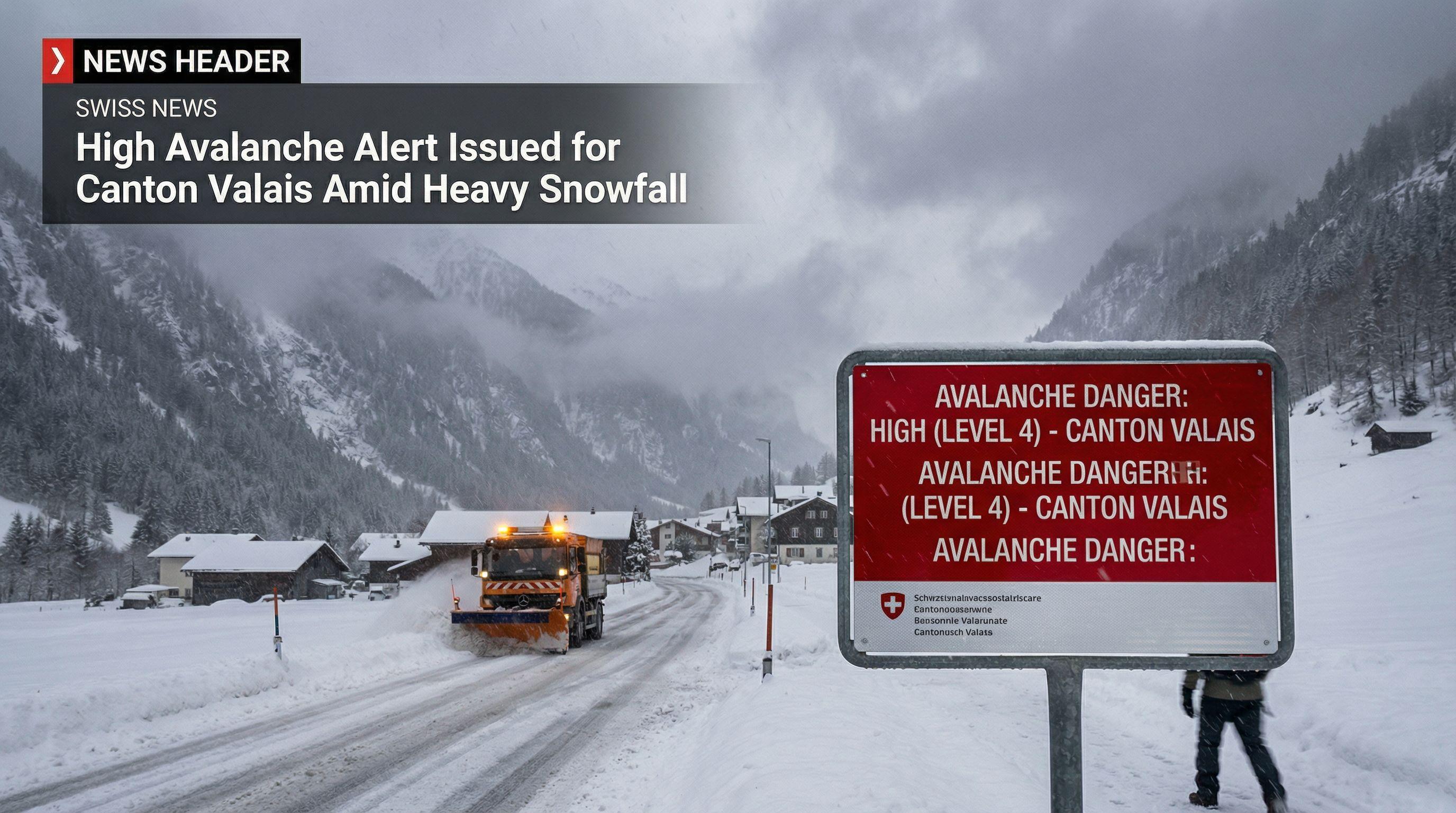
Authorities have raised the avalanche danger to 'high' (level four of five) in canton Valais due to heavy snowfall and strong winds. The warning highlights the risk of both naturally occurring and easily triggered avalanches, with potential impact on exposed roads and ski areas.
"All current weather models also indicate an unstable westerly regime with rain, snow, and intermittent winds for the coming week."
"Large amounts of fresh snow and drifting snow have built up over an older weak layer of snow, meaning avalanches can be easily triggered or may occur naturally in many areas."
The Swiss Federal Institute for Forest, Snow and Landscape Research (WSL) has escalated the threat level to a critical 'high'—level four on the five-point scale—signaling an immediate and severe danger across the region. This is not a drill; the combination of heavy snowfall and ferocious winds has created a volatile cocktail in the mountains, particularly in southwestern Switzerland. Authorities are issuing urgent warnings as the risk of naturally occurring avalanches surges, threatening exposed roads and transportation networks.
The situation is developing rapidly. Since Tuesday evening, the danger curve has spiked, forcing officials to warn that very large avalanches could release spontaneously within the affected zones. This escalation places Canton Valais at the epicenter of a severe winter storm system, with the alert level standing just one notch below the maximum catastrophe rating. For residents and travelers in the region, the message is stark: the mountains are currently unstable, and the risk to public safety is palpable.
A staggering amount of snow is pummeling the Alps, with meteorologist Peter Wick forecasting accumulations surpassing one metre in Lower Valais by the weekend. This deluge is concentrated above 1,500 to 1,800 metres, burying the landscape under a massive weight of fresh powder. While Valais takes the brunt of the storm, the rest of the country is not spared. The Bernese Alps are bracing for up to 80 cm of fresh snow, while the Central and Eastern Alps are expected to receive between 40 and 60 cm.
Even Central Graubünden is confronting significant accumulation, with 20 to 40 cm predicted. The snow line is plummeting to 1,200 metres, bringing winter conditions down to lower elevations. This intense precipitation is a double-edged sword; while it promises excellent conditions for the future, the immediate volume is overwhelming the existing snowpack. The sheer speed and density of this snowfall are creating a heavy load that the mountains are struggling to support.
Winter sports enthusiasts are being urged to stay on marked runs as the off-piste environment turns into a potential death trap. The Institute for Snow and Avalanche Research SLF warns that the fresh snow is sitting precariously atop an older, weak layer, creating a structure that is structurally unsound. Combined with drifting snow caused by strong winds, this 'slab' effect means avalanches can be triggered with terrifying ease—often by the weight of a single skier.
The danger is not limited to the 'high' risk red zones of Valais. A considerable danger (level three) stretches from the Bernese Oberland to Graubünden. The bulletin explicitly warns that conditions are poor for ski tours and freeriding. Venturing away from secured runs right now is a gamble with the highest stakes. The structural weakness in the snowpack is invisible to the naked eye, making the current stability deceptive and highly volatile.
The chaos isn't confined to the peaks. The lowlands are grappling with a violent westerly regime, with wind gusts screaming between 60 and 80 km/h. As the mountains bury under snow, the lower elevations are being soaked, with 30 to 50 litres of rain per square metre expected by Friday morning—and even higher volumes in the west. This combination of gale-force winds and heavy precipitation is creating miserable conditions across the Swiss plateau.
Looking ahead, there is no silver lining in the immediate forecast. "All current weather models also indicate an unstable westerly regime with rain, snow, and intermittent winds for the coming week," states meteorologist Peter Wick. Switzerland is locked into a pattern of turbulence, meaning the high avalanche risks and travel disruptions are likely to persist. Residents should prepare for a prolonged period of aggressive winter weather that shows no signs of letting up.