AI
Written with AI assistance•February 11, 2026•
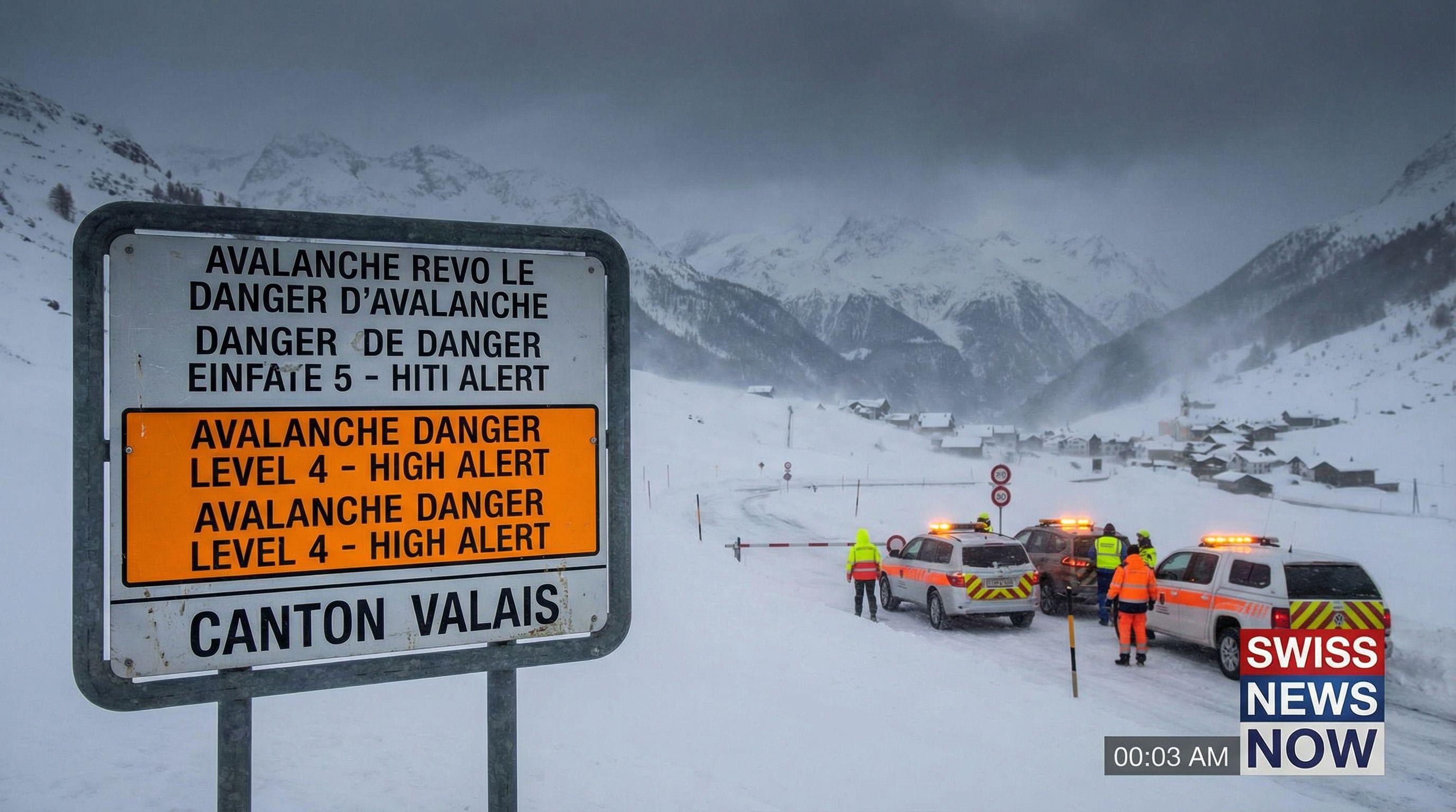
Swiss authorities have raised the avalanche danger to level four ('high') in canton Valais following heavy snowfall and strong winds. The bulletin warns that very large avalanches may occur naturally and could affect exposed roads and infrastructure.
"All current weather models also indicate an unstable westerly regime with rain, snow, and intermittent winds for the coming week."
"Large amounts of fresh snow and drifting snow have built up over an older weak layer of snow, meaning avalanches can be easily triggered or may occur naturally."
The danger level has skyrocketed to critical heights in southwestern Switzerland. Swiss authorities have officially raised the avalanche alert to Level 4—'High'—for Canton Valais, a move that signals an immediate and severe threat to life and infrastructure. This is not a drill for winter sports enthusiasts; it is a red alert. The Swiss Federal Institute for Forest, Snow and Landscape Research (WSL) warns that the situation has deteriorated rapidly since Tuesday evening, driven by a lethal combination of heavy fresh snow and unstable drifts sitting atop weak, older layers.
Spontaneous, large-scale avalanches are now expected to occur naturally. The threat is no longer confined to the high peaks; the bulletin explicitly warns that exposed roads and transportation arteries could be in the direct path of sliding snow masses. For anyone considering off-piste ventures, the message is stark: conditions are treacherous. With the risk level sitting just one notch below the maximum scale, local authorities are bracing for potential road closures and are urging extreme caution across the canton.
A staggering one meter of fresh powder is set to bury Lower Valais by the weekend, transforming the landscape into a beautiful but deadly trap. Meteorologist Peter Wick confirms that the region is in the crosshairs of a massive winter blast, with the heaviest accumulations targeting elevations above 1,500 to 1,800 meters. This is not a gentle dusting; it is a deluge of white that is rapidly overloading the snowpack.
The sheer volume of precipitation is relentless. While Valais takes the brunt of the storm, the Bernese Alps are also grappling with up to 80 cm of fresh snow, while the Central and Eastern Alps confront accumulations of 40 to 60 cm. The snow line is plummeting to 1,200 meters, bringing winter conditions down to the doorsteps of mid-altitude villages. This rapid loading of the slopes significantly increases stress on the snow cover, creating a hair-trigger environment where the weight of a single skier—or simply the force of gravity—could unleash disaster.
While Valais stands at the epicenter of this crisis, the threat radiates outward across the entire Swiss Alpine arc. A vast region stretching from the Bernese Oberland to Graubünden is currently under a Level 3 'Considerable' avalanche danger. In these orange-coded zones, the situation remains precarious for outdoor enthusiasts. Even in Central Graubünden, where snowfall is lighter at 20 to 40 cm, the wind-transported snow remains a critical instability factor.
The Institute for Snow and Avalanche Research SLF emphasizes that the danger is not static; it is dynamic and rising. Drifting snow—moved by strong winds—is building fragile slabs that are notoriously difficult to detect. For the thousands of tourists enjoying the traditional school ski holidays, this bulletin serves as a vital check on behavior. Staying on secured, marked runs is currently the only safe option. Venturing off-piste in these conditions is not merely risky; it is a gamble with the highest stakes imaginable.
The fury of this storm system isn't confined to the peaks; the Swiss lowlands are being lashed by a powerful westerly front. Gusts of 60 to 80 km/h are tearing through the plateau on Wednesday and Thursday, turning urban commutes into hazardous trials. In addition to the wind, a soaking 30 to 50 liters of rain per square meter is expected to drench the lower elevations by Friday morning, with the west of Switzerland facing the heaviest downpours.
There is no immediate relief in sight. Meteorologist Peter Wick warns of a persistent "unstable westerly regime" that will dominate the forecast well into next week. This means a relentless cycle of rain, snow, and intermittent winds will continue to batter the country. As the weekend approaches, Switzerland remains locked in a turbulent battle with the elements, requiring vigilance from the high-altitude passes of Valais to the wind-swept streets of Zurich.