Switzerland
Unstable glacier near Zermatt puts alpine communities on alert
A glacier near Zermatt is breaking apart and could send debris toward the town below, highlighting the risks created by unstable alpine ice. The article should explain the immediate hazard, how authorities monitor glacier collapses and what the episode reveals about risks to mountain communities and infrastructure.
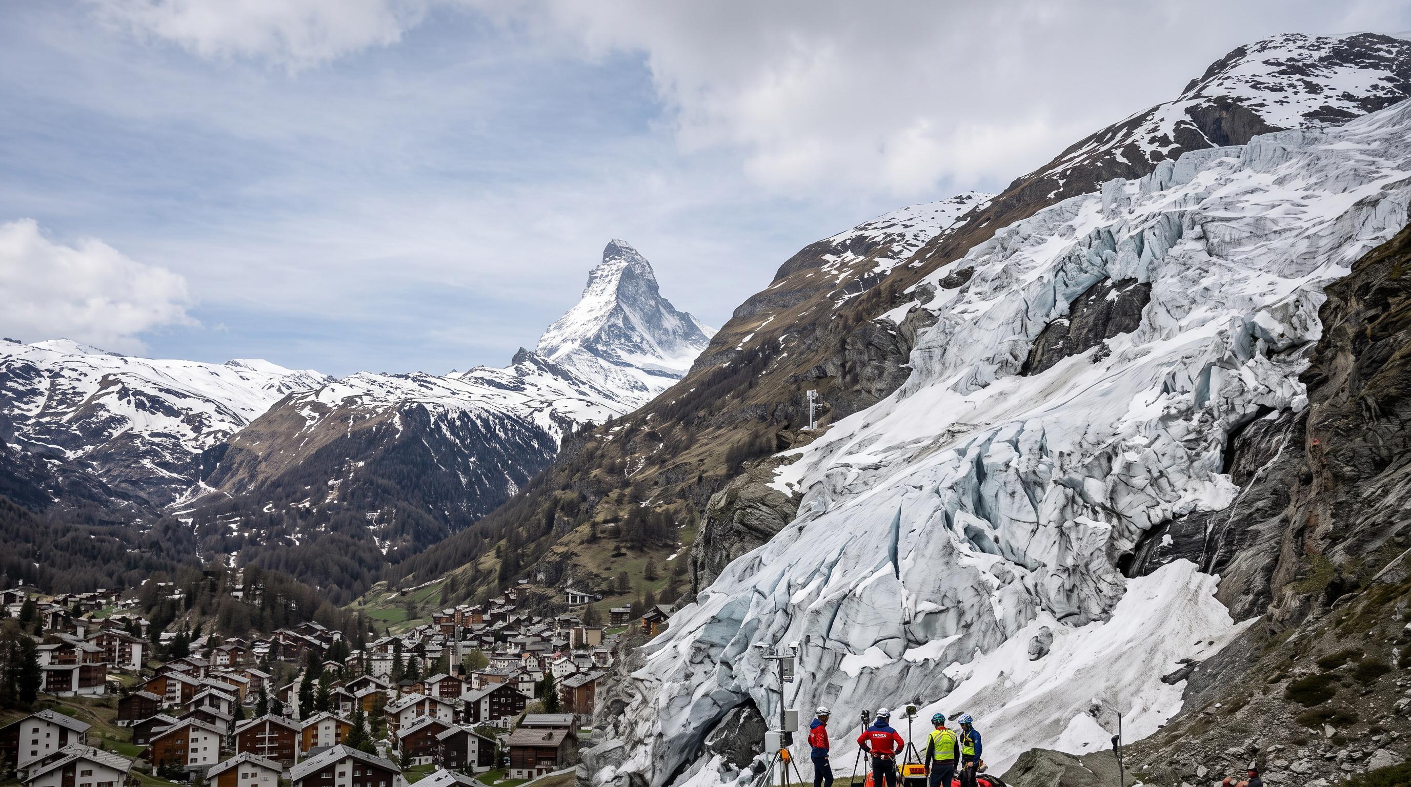
Ice Breaks Above Randa
A glacier above Randa is shedding ice with the town below on alert. The Weisshorn glacier, at 4,505 metres near Zermatt in Valais, is breaking off piece by piece. Fragments have detached from the glacier but remain suspended on its lower plateau, creating the possibility of a larger fall toward the valley floor.
Randa authorities have raised monitoring to level 3 and closed the area to the public. Their warning is precise: “Over the next few days, ruptures are possible.” Officials have not ordered an evacuation. They also say there are currently no signs that the debris will reach Randa.
The response reflects the narrow margin for error in steep Alpine terrain. Ice can remain apparently fixed while cracks widen, then release rapidly under gravity. A collapse could send blocks and snow downslope, potentially affecting paths, roads or other infrastructure, depending on the direction and scale of the fall.
For now, residents face a controlled warning rather than an emergency relocation. The municipality is watching the glacier continuously, while restricting access to keep hikers, climbers and local workers away from the exposed zone.
Radar Tracks Every Shift
Interferometric radar is helping authorities measure movement that the human eye cannot reliably track. The specially installed system scans the unstable glacier and detects changes in its surface position. That information allows specialists to assess whether the ice is accelerating, stabilising or approaching a possible rupture.
Randa’s authorities said the situation is being monitored closely to determine whether the elevated danger persists or eases. The level 3 warning therefore marks an active assessment phase. It does not mean that a collapse has occurred or that every scenario points toward the village.
Monitoring matters because glacier hazards can develop away from settled areas and become dangerous when ice, rock and meltwater follow steep channels into the valley. Radar data can support decisions on access restrictions, local warnings and evacuation planning. It works alongside visual inspections and information from geological and glaciological specialists.
The public closure removes one immediate source of risk. In the high mountains above Zermatt and Randa, tourist routes and climbing areas can bring people beneath unstable slopes. Keeping those routes closed gives authorities time to interpret the measurements before conditions change again.
Blatten Remains the Warning
Blatten’s destruction in May 2025 showed how quickly a glacier hazard can become a village emergency. The Valais community was largely wiped out after a dramatic collapse, although authorities had evacuated its 300 residents beforehand. The event remains a direct reference point for communities living beneath unstable ice and rock.
The situation at Randa is different in its known details. The Weisshorn debris remains attached to the lower glacier plateau. Authorities have reported no indication that it will reach the village, and no evacuation order has been issued. Those assessments can change if radar readings show faster movement or if new fractures appear.
A collapse does not always arrive as a single spectacular wall of ice. Pieces can detach progressively, strike lower slopes and destabilise surrounding material. In some Alpine settings, meltwater can also collect behind debris or travel rapidly through existing channels. The consequences depend on the volume released, the terrain and the location of roads, homes and other infrastructure.
Randa’s precautions show how Swiss municipalities manage that uncertainty: restrict access, communicate a defined warning level and prepare to escalate if measurements justify it.
Heat Changes the Risk Map
Swiss glaciers are losing an estimated 400 cubic metres of water every second, a pace that is reshaping the hazards faced by Alpine communities. The figure captures a national process that extends well beyond one unstable ice mass. Retreat changes the weight and support conditions on mountain slopes, exposes unstable rock and alters meltwater routes.
GLAMOS, the Swiss Glacier Monitoring Network, has found that more than 1,100 Swiss glaciers disappeared completely since the early 1970s. The loss is visible in valleys across Valais and other mountain regions, where ice once helped define the landscape and regulate seasonal water flows.
Matthias Huss, who heads GLAMOS, has identified prolonged heatwaves as the worst-case scenario for glaciers. Heat increases melting at the surface and can weaken ice that already contains fractures. Climate change does not determine the exact timing or path of a collapse, and local geology remains decisive. It does increase the background pressure on many glacier systems.
That combination requires municipalities to treat glacier monitoring as long-term public infrastructure. Roads, rail links, hydropower facilities, tourism sites and settlements all depend on decisions made before a slope becomes visibly dangerous.
Switzerland Prepares for a More Unstable Alps
Randa’s alert will be measured in hours and days, while Switzerland’s glacier problem will be managed over decades. Authorities must decide when a warning is sufficient, when access must be restricted and when residents should leave. Those decisions rely on measurements, terrain modelling, weather conditions and clear communication with the public.
The current closure near the Weisshorn limits exposure while specialists study the ice. Residents have been warned about possible ruptures, but officials have not presented a collapse as inevitable. That distinction matters in a region where tourism, transport and daily life operate close to steep mountain slopes.
The episode also places pressure on Alpine planning. Communities need updated danger maps, evacuation routes, reliable communications and exercises that include residents, visitors and businesses. Infrastructure operators must account for debris flows, rockfall and sudden changes in meltwater as glaciers retreat.
Zermatt’s international profile brings large numbers of visitors into a landscape governed by mountain processes. The same systems that draw people to the region can become hazardous without much visible notice. For Randa, the next decision will come from the monitoring data. For Switzerland, the wider task is building that data into everyday safety planning.